
It never erupted
Molten rock rose through the crust and cooled before it reached the surface. That slow, buried cooling is what gave it big, visible crystals instead of the fine grain of a lava.
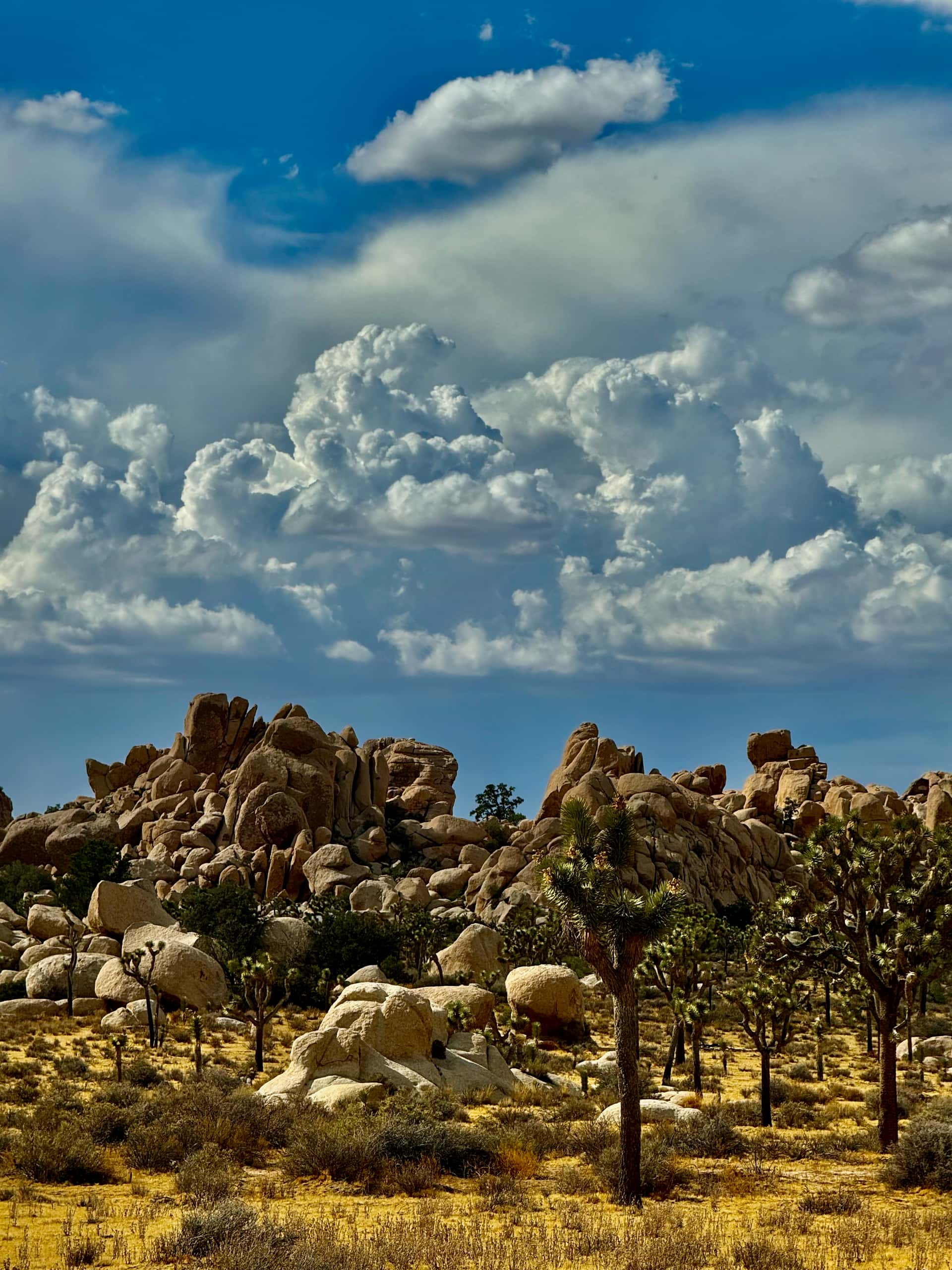
Why the boulders are round, what the stripes in a desert stone mean, and how a place this battered still shows fewer craters than the Moon. Written and photographed from the high desert.
The pale, rounded boulder piles Joshua Tree is known for are monzogranite, a light-coloured igneous rock that cooled from a melt while it was still underground. The National Park Service names the body the White Tank monzogranite and places the birth of this landscape more than 100 million years ago. Popular accounts usually put the rock itself at about 85 million years, in the Late Cretaceous, though that figure does not appear on the Park Service or US Geological Survey pages for the park. Older and far less famous is the dark, banded metamorphic rock long called Pinto Gneiss, which the USGS dates to between 1.4 and 1.7 billion years.
Everything below is written from walking this ground and picking things up off it. Where a number appears, the body that published it is named, and where the published numbers disagree with each other, this page says so instead of choosing the roundest one. Full sources are listed at the foot of the page.
Joshua Tree National Park is not one desert. The Park Service describes the Colorado Desert as restricted to the south and east of the park below roughly 3,000 feet, with the higher, moister and slightly cooler Mojave Desert lying across the western and northern regions. The Colorado Desert is itself a western extension of the Sonoran.
That elevation line is the reason the Joshua trees stop where they stop. It is also why this is called the high desert at all: the town of Joshua Tree sits at about 2,900 feet, which buys colder nights, thinner air, the occasional February snowfall, and the clear, steady skies this company exists because of.
For the rock it matters in a plainer way. Higher ground means harder freezing and more aggressive physical weathering, and the difference in what you find underfoot between the two halves is not subtle once you know to look.
The transition itself is the best of both. All four stones further down this page came out of it, on the lower desert side in San Bernardino County.
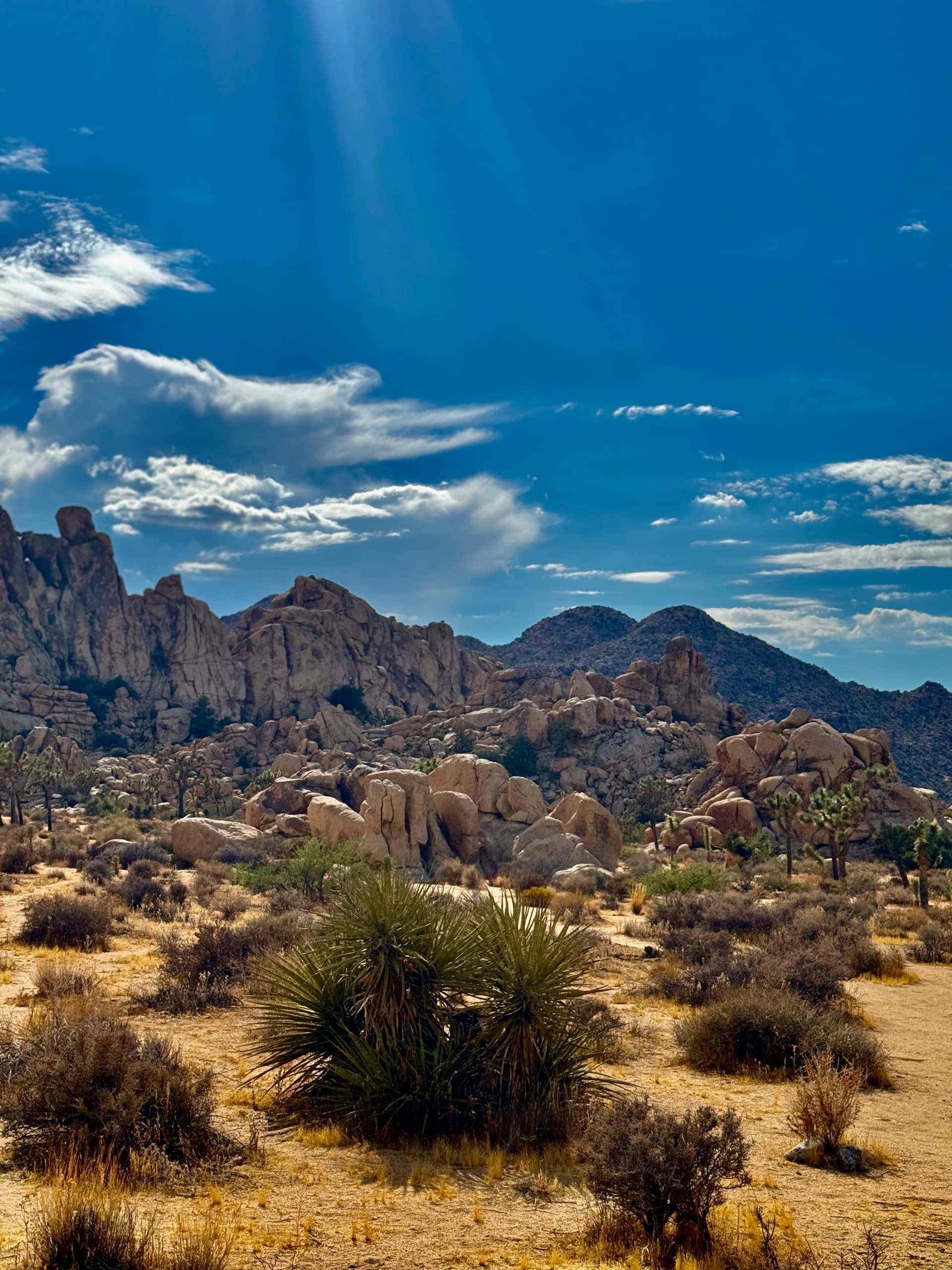
The most common thing visitors assume about Joshua Tree is that wind sculpted the rock piles. It did not. Almost all of the shaping happened out of sight, under the surface, in water.
Molten rock rose through the crust and cooled before it reached the surface. That slow, buried cooling is what gave it big, visible crystals instead of the fine grain of a lava.
As the mass cooled and the weight above it eased, it fractured along joints running in roughly perpendicular sets, cutting the body into rough rectangular blocks while it was still underground.
Groundwater worked down through those joints and turned hard mineral grains along its path into soft clay. It attacked corners and edges fastest, because a corner is exposed on three sides at once. The rectangular blocks became spheres of hard rock sitting in soft clay, and this happened while they were still buried.
Flash floods and time stripped out the clay and loose grains, letting the rounded boulders settle onto one another. The piles you can climb today were shaped out of sight, and only later uncovered.
The US Geological Survey calls the rounding stage spheroidal weathering. The Park Service adds a detail worth carrying around: the landforms here are relict features, inherited from a time of higher rainfall and lower temperatures than the desert has now. The landscape you are looking at was made by a wetter climate than the one you are standing in.
Four stones from my own collection, photographed at home, all picked up in the same stretch of desert. What follows is how to read the textures in them, not a claim about what each one is: no rock can honestly be identified from a photograph, and identification in the hand comes down to grain size, hardness and what the minerals actually are.
All four were picked up in the lower desert of San Bernardino County, in the transition where the Colorado Desert gives way to the Mojave. That is the same boundary described further up this page, and it is not a coincidence that this is where the interesting stones are.
Look at how unlike each other they are. Granite speckle, metamorphic banding, milky quartz and green altered rock, and every one of them rounded. Rounded means water moved them, and in this desert that means a wash: the flat braided gravel beds that run only during the few storms a year heavy enough to move anything.
A wash bed is not one rock type. It is a sample of everything upstream of it, tumbled together and sorted by size.
That is the single most useful thing to understand about looking for rock in the low desert. A hillside gives you one outcrop and one answer. A drainage gives you a collection that the mountains above it assembled for you, which is why four stones this different can come from one afternoon in one place.
These four are part of a collection built up over years, not gathered for this page. Most of what I pick up does not stay with me: I have spent years donating specimens to local schools and teachers to use as geology samples, so the stones a classroom around here holds up to explain banding or a rounded cobble may well have come out of the same wash as the ones photographed below.
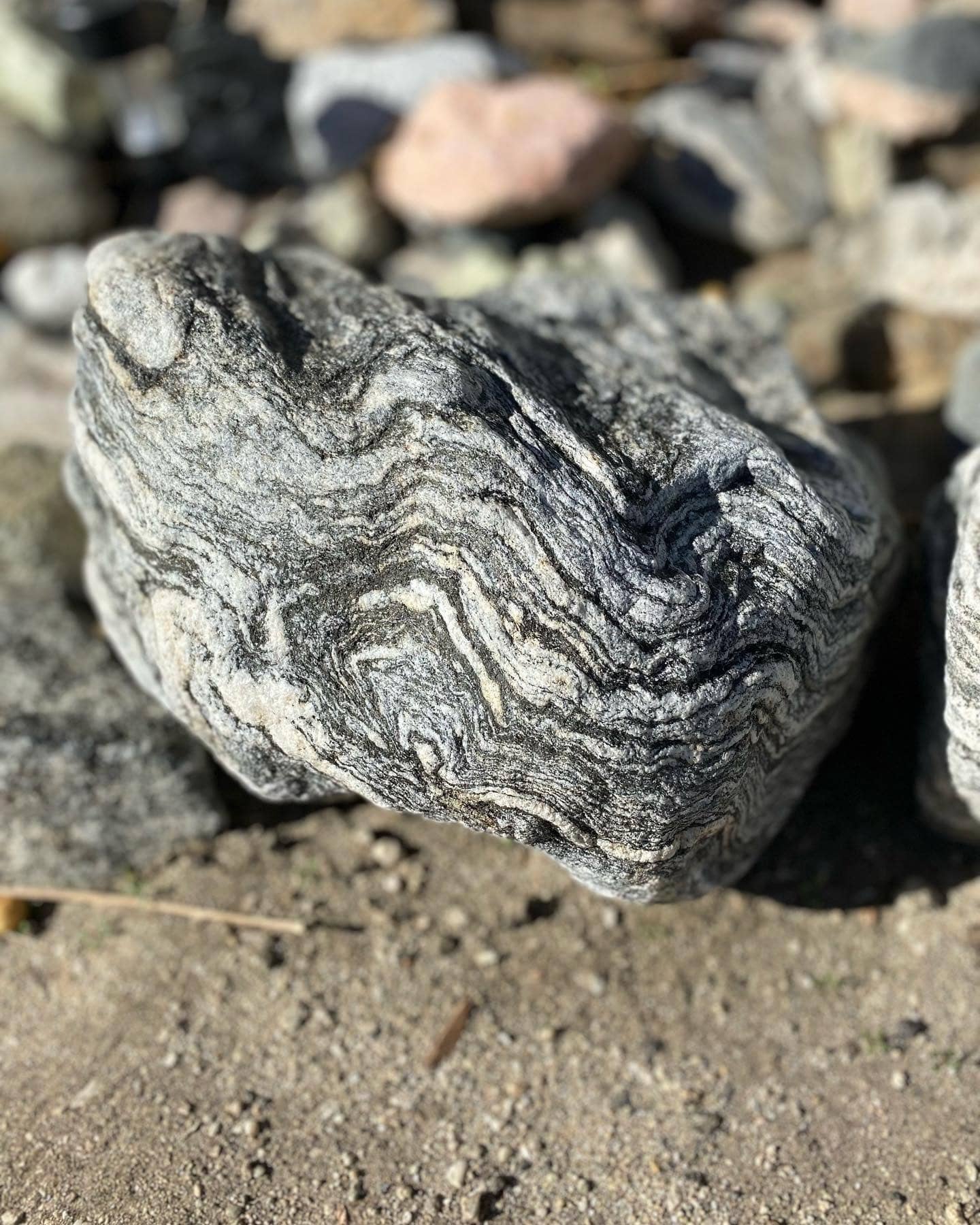
Straight stripes in a stone mean its minerals were sorted into layers. Stripes that loop, buckle and fold back like this mean the rock was squeezed hard after those layers already existed, deep enough down that it bent instead of snapping. Every fold you can see is a direction something pushed from. This is the single most rewarding texture to find in the high desert, and it is the reason a plain grey cobble is worth turning over.
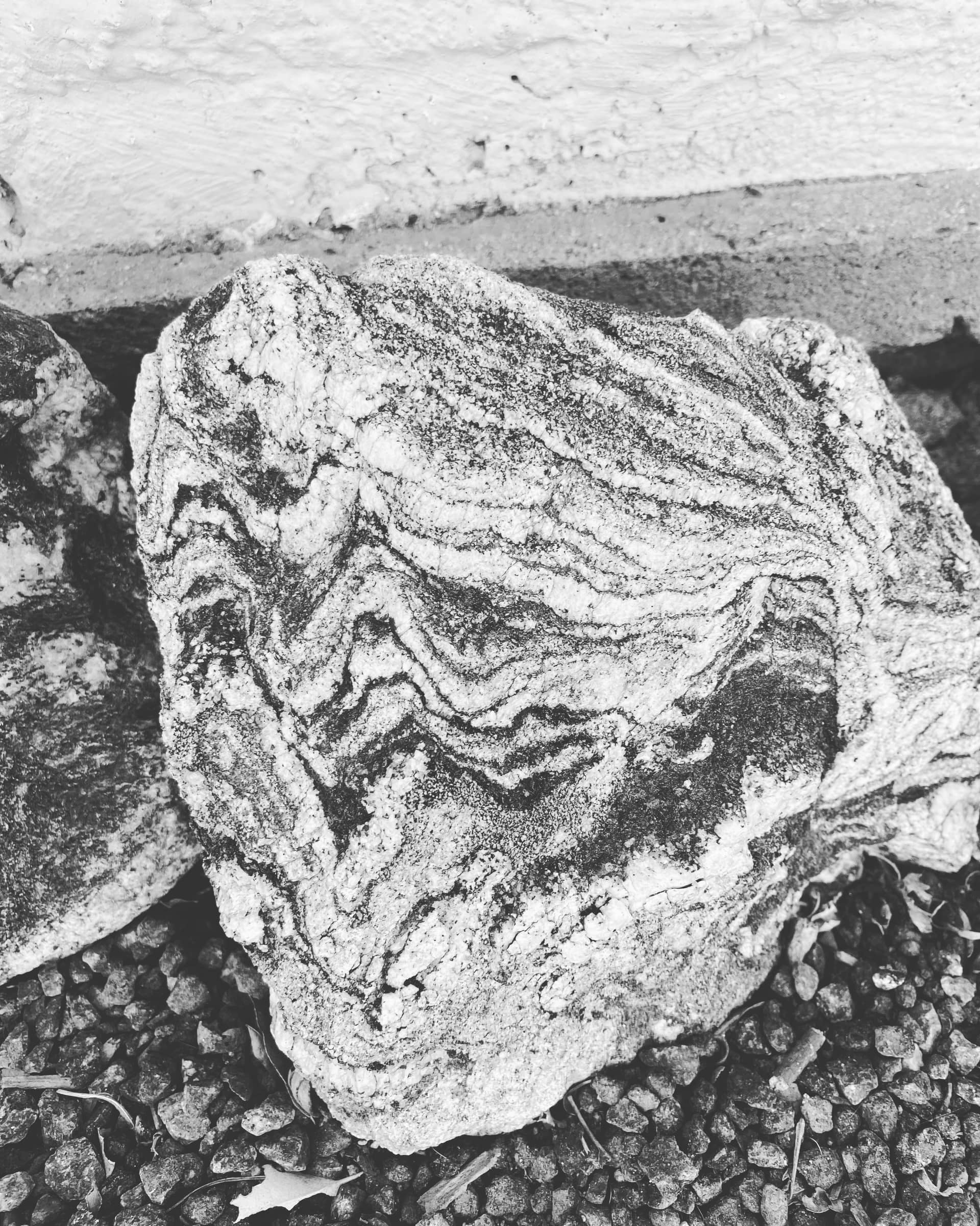
Colour is the loudest thing about a stone and usually the least informative: it comes from staining, desert varnish, and whatever was growing on it. Take the colour away and the structure is all that is left. Shot in monochrome, the chevrons in this one read like contour lines, and you can follow a single pale band from one edge of the face to the other. If you photograph your own finds, try it both ways.
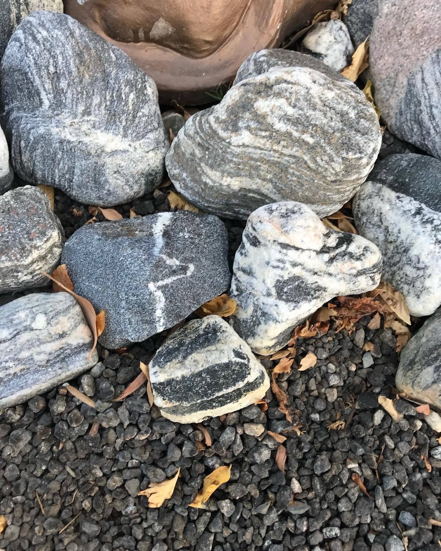
This is the useful comparison, because all three are in one frame. An even salt-and-pepper speckle with no direction to it says the rock cooled from a melt and the crystals grew wherever they liked: that is the granite family, the stuff the boulder piles are made of. A strong stripe says the minerals were sorted into layers by heat and pressure: the metamorphic family. And a bright white line cutting straight across everything else, ignoring the pattern it crosses, came later than the rock it is in, filled in by mineral-rich water moving through a crack. Anything that cuts across is younger than what it cuts.
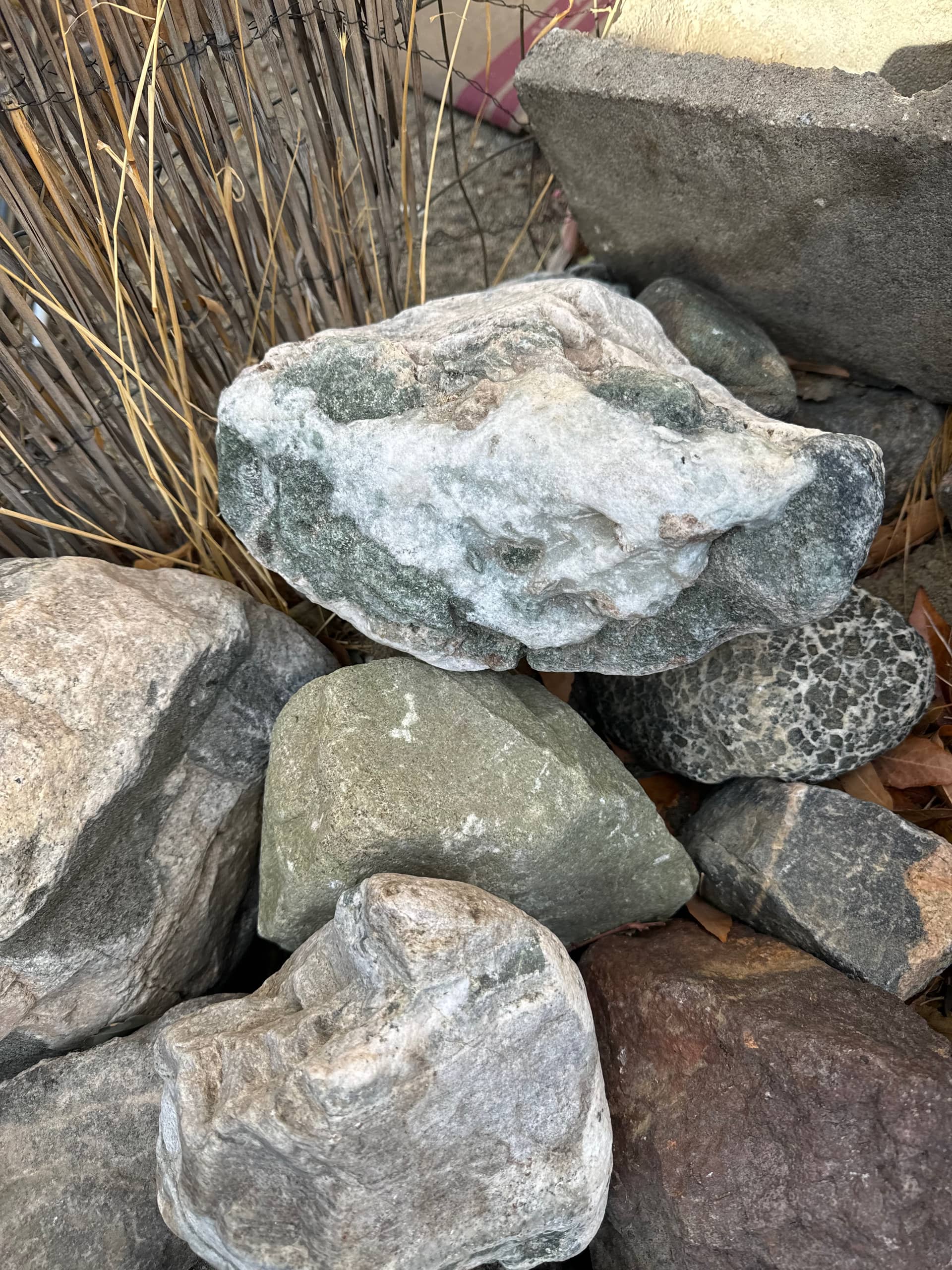
The milky white here is quartz, which is why there is so much of it lying around: quartz is hard, chemically stubborn, and outlasts the minerals it formed alongside, so it survives at the surface long after its parent rock has crumbled to grus. Strong greens in desert stone usually come from the chlorite and epidote family, which form when an existing rock is altered by hot water and pressure rather than being what the rock started as. Green is a good reason to keep a stone.
The banded metamorphic rock of this region has been called Pinto Gneiss for a long time. It began as sediments and older igneous rock, was buried deep, and was then rebuilt by pressure and heat: its mineral grains changed size, changed composition and lined themselves up, which is what produces the alternating pale and dark banding that makes a gneiss recognisable across a room.
Its age is genuinely unsettled, and the published figures span roughly 400 million years.
There is a naming problem underneath the numbers. The USGS lexicon treats “Pinto Gneiss” as a preoccupied name, and modern mapping has broken the old catch-all into several separate units. So it is best read as a legacy umbrella term for the region’s ancient metamorphic basement rather than as one formation with one date.
The safe sentence, and the one worth repeating, is this: the oldest rock here is Proterozoic, well over a billion years old, and probably the oldest thing you will ever physically touch. The Park Service hedges its own “oldest rock in the park” claim as most likely rather than certain, and so should anybody quoting it.
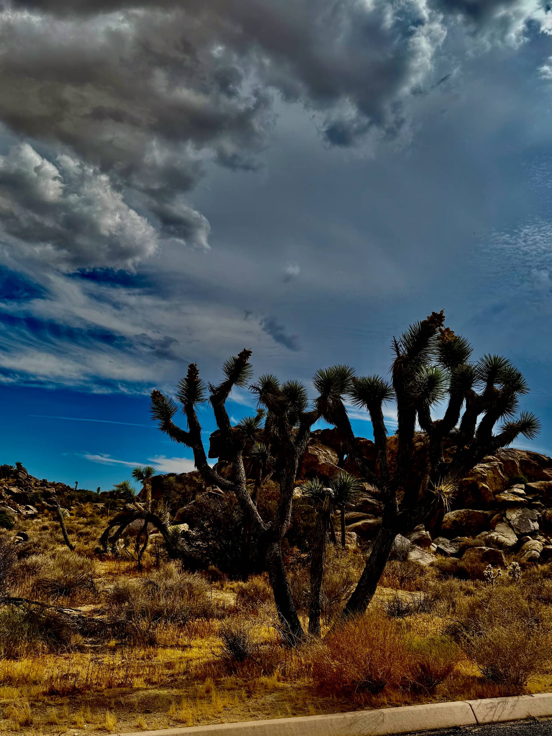
The San Andreas Fault bounds the south side of the park, and the Park Service notes it can be observed from Keys View. On a clear afternoon the valley floor below that overlook is a plate boundary you are looking down at, which is an odd thing to eat a sandwich in front of.
To the north, the Pinto Mountain Fault runs east to west near Twentynine Palms. The Park Service points out that the Oasis of Mara, at the visitor centre there, marks it: water is forced to the surface along the fault line, which is why a stand of fan palms exists in the middle of a desert.
None of this is finished. The rounded boulders were shaped under a wetter climate, the old gneiss was folded under mountains that no longer exist, and the whole assembly is still being carried sideways a few millimetres a year. It is a useful contrast to hold when you look up.
This needs saying plainly on a page that shows off a rock collection. The National Park Service states that “collecting, rockhounding, and gold panning of rocks, minerals, and paleontological specimens, for either recreational or educational purposes is generally prohibited in all units of the National Park System”, under 36 CFR 2.1(a) and 2.5(a).
Note the wording of the regulation: it prohibits possessing a mineral resource, not only removing one. Picking a stone up and putting it in a pocket is already the offence, and you do not have to reach the gate with it.
Specimens have to come from outside park boundaries, from land where collecting is actually permitted. Inside the park the rule is the good one anyway: photograph it, put it back, and leave the next person the same thing you found.
Earth and the Moon sit in the same neighbourhood and have been struck at comparable rates for four and a half billion years. Look up on a clear night from this desert and the Moon is covered in the evidence. Look down and there is almost none. The difference is not what happened. It is what survived.
Everything on this page is a description of erasure. Water turned granite corners to clay. Floods carried the clay off. Faults dragged the whole assembly sideways. An atmosphere burned up the small impactors before they ever landed, and plate tectonics has recycled most of the crust that took the rest. Earth is relentlessly good at losing its own history, which is exactly why a billion-year-old gneiss is a rare and slightly miraculous thing to be holding.
The Moon has no running water, no weather and no plate tectonics. Nothing rubs anything out. A crater that formed before there was complex life on Earth is still there, still sharp, still measurable, and still, in over a million cases, completely unnamed. That permanence is the entire premise of this company: the ground under your feet forgets, and that ground up there does not.
The pale, rounded boulder piles Joshua Tree is known for are monzogranite, a light-coloured intrusive igneous rock in the granite family, which the National Park Service names the White Tank monzogranite. It cooled from molten rock while still below the surface, which is why its crystals are large enough to see. The park also contains much older metamorphic rock, long known collectively as Pinto Gneiss, and a range of other intrusive bodies.
They were rounded underground, not by wind. The monzogranite cracked into roughly rectangular blocks along joint fractures while it was still buried. Groundwater moving down those joints turned hard mineral grains into soft clay, attacking the corners and edges fastest, so the blocks weathered into spheres surrounded by soft material. Erosion later washed the soft material away and the rounded boulders settled on top of one another. The US Geological Survey calls the rounding stage spheroidal weathering.
The oldest rocks are Proterozoic metamorphic rocks, traditionally called Pinto Gneiss. Published ages disagree: the US Geological Survey gives the park’s oldest rocks as 1.4 to 1.7 billion years old, while a National Park Service page describes Pinto Gneiss as estimated at more than 1.8 billion years. Modern USGS mapping has also split the old Pinto Gneiss name into several separate units, so it is best treated as a legacy umbrella term rather than a single formation.
No. The National Park Service states that collecting, rockhounding and gold panning of rocks, minerals and paleontological specimens, for either recreational or educational purposes, is generally prohibited in all units of the National Park System, under 36 CFR 2.1(a) and 2.5(a). The regulation prohibits possessing as well as removing a mineral resource, so specimens must come from outside park boundaries and from land where collecting is permitted.
Strongly banded light-and-dark rock is characteristic of gneiss, a metamorphic rock in which heat and directed pressure have segregated minerals into alternating layers. Where those bands loop and fold rather than running straight, the rock was deformed while deep and hot enough to bend instead of fracture. A rock cannot be identified with certainty from a photograph, and identification in the hand depends on grain size, hardness and mineral content.
Washes and alluvial fans are the productive ground. Running water rounds rock and carries it down off the surrounding ranges, so a wash bed is a natural sample of every rock type upstream of it, tumbled together and sorted by size. That is why a single drainage can yield granite, banded metamorphic rock, milky quartz and green altered stone within a few paces, while a hillside outcrop gives you one rock type and one answer. The transition zone where the Colorado Desert meets the Mojave is particularly varied. Collecting is prohibited inside Joshua Tree National Park and every other National Park System unit under 36 CFR 2.1, so collecting must be done outside those boundaries on land where it is permitted.
Both were hit at comparable rates. Earth erases the evidence and the Moon does not. Earth has an atmosphere that destroys smaller impactors before they land, running water and wind that wear craters down, and plate tectonics that recycles the crust entirely. The Moon has no atmosphere, no running water and no plate tectonics, so a crater formed billions of years ago is still there, still sharp. That is why lunar craters are a usable record and terrestrial ones mostly are not.
Photographs on this page are the author’s own and are not licensed for reuse. The Joshua Tree Crater Company is independent and is not affiliated with, endorsed by, or connected to the National Park Service or the US Geological Survey.
About the author